



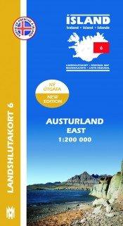
Regional Map 6 - East 1:200,000
Regional Map 6 - East 1:200,000
Navigate the stunning landscapes of Iceland with the Regional Map 6 - East 1:200,000. This essential travel guide is divided into eight accessible sections, showcasing vital information about the local road systems, campsites, swimming pools, and golf courses. With over 26,000 place names, finding your way around has never been easier.
On the reverse, you'll find insights into the region’s natural wonders, complemented by vibrant photographs and multilingual descriptions. Plus, enjoy illustrations of the various birds and plants unique to Iceland. Perfect for any adventurer, this map transforms your travel experience into a captivating journey through nature!
Author: Hans Hjálmar Hansen
Published: 2013
What features are included in the map?
The map includes road systems, campsites, swimming pools, golf courses, and over 26,000 place names.
Is the map suitable for outdoor adventurers?
Absolutely! It's designed for travelers who want to explore Iceland's natural beauty.
What languages are used on the map?
The map features descriptions in four different languages for easier navigation.
Who is the author of this map?
The map is authored by Hans Hjálmar Hansen and was published in 2013.
Regional Map 6 - East 1:200,000
Prix de vente$20.00 USD
What features are included in the map?
The map includes road systems, campsites, swimming pools, golf courses, and over 26,000 place names.
Is the map suitable for outdoor adventurers?
Absolutely! It's designed for travelers who want to explore Iceland's natural beauty.
What languages are used on the map?
The map features descriptions in four different languages for easier navigation.
Who is the author of this map?
The map is authored by Hans Hjálmar Hansen and was published in 2013.